Skip to content
Planform Development Group

Project 02 · Illustrative Project

Kopano Corridor

An illustrative study testing how a single transport corridor can restructure a township economy through incremental, plot-level intervention.

Location
Township edge, Eastern Cape
Scale
16 kilometres
Year
2025
Status
Illustrative Project
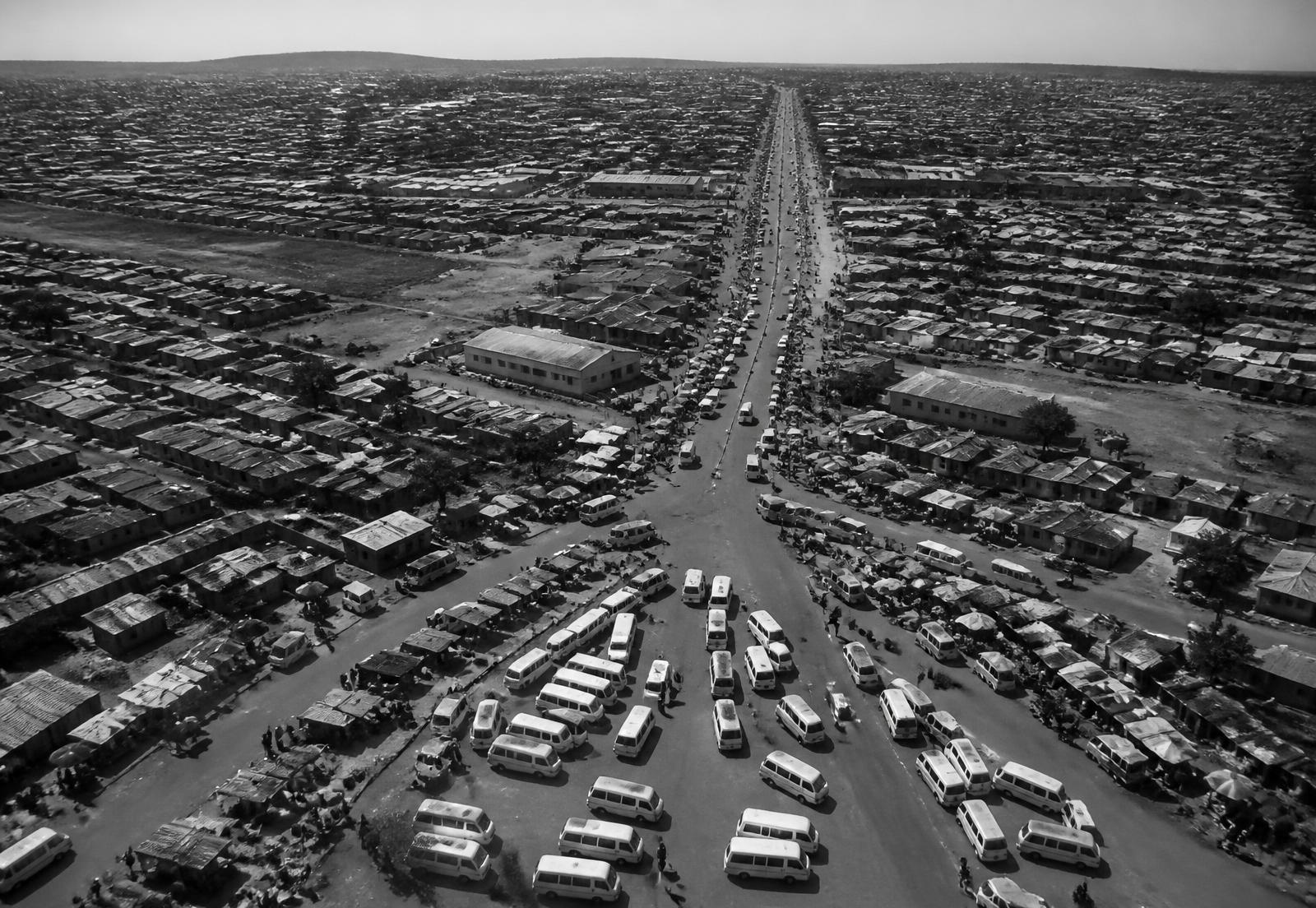
Aerial context photograph of the Kopano Corridor study area
Context — study area
Corridor length
16 km
Nodes
9
Traders accommodated
≈ 1 400
Horizon
8 years

The study

From context to implementation.

Context

A 16 kilometre arterial carries the majority of daily commuter movement between a township and the regional economic centre. Trade, transport interchange and services have accumulated along it informally, without servicing, shade or safe pedestrian space.

Opportunity

The corridor already concentrates demand. Formalising the interchange points and releasing narrow plot depths for incremental construction could create economic capacity without acquiring new land.

Vision

Nine calibrated nodes along one corridor, each combining a transport interchange, serviced trading infrastructure and a small public square, connected by a continuous shaded pedestrian route.

Masterplan

Nodes are spaced at walking intervals and sized by observed passenger volume. Between nodes the corridor is treated as a linear street: continuous walkway, planted verge, lighting, and plot-width subdivisions allowing incremental frontage development.

Urban systems

Pedestrian priority within 200 metres of each node. Minibus taxi movement is separated from through traffic through dedicated laybys. Lighting and sightlines are treated as primary safety infrastructure.

Housing strategy

The study is not a housing project, but it models roughly 900 units of incremental upper-floor accommodation above trading frontage across all nine nodes over fifteen years.

Infrastructure

Water points, ablutions, waste handling and three-phase power at each node. Servicing is designed as a repeatable kit rather than nine bespoke designs.

Landscape

Continuous indigenous street tree planting for shade, with hardened trading surfaces and permeable verges.

Economic impact

The study models formalised trading bays for approximately 1 400 existing traders, with tenure that protects current occupants rather than tendering the space to new entrants.

Environmental impact

Shade and permeable surfacing reduce surface temperature and runoff along a corridor that currently has neither.

Drawings

Interactive technical set.

Corridor analysis

Movement volumes, trade concentration and interchange points.

Node type plan

Repeatable interchange, trading and square configuration.

Corridor section

Walkway, verge, laybys and frontage relationship.

Rollout sequence

Pilot, monitoring and phased rollout.

Delivery

Implementation timeline.

  1. PilotYear 1

    Two nodes constructed and monitored for twelve months.

  2. Rollout AYear 2–5

    Four nodes, corridor walkway and lighting.

  3. Rollout BYear 5–8

    Remaining three nodes, incremental frontage support.

Estimated budget

  • Node kit (per node)Repeatable unit cost — indicative
  • Corridor walkway and lightingPer kilometre rate — indicative

Budget figures are indicative and modelled for planning purposes only. They are not tendered costs and do not constitute a commitment or an offer.

Contact

Discuss this project.

Framework documentation is available to municipalities, landowners and investment partners on request.