Skip to content
Planform Development Group

Project 03 · Concept Proposal

Atlas New Town

A structural framework for a new peri-urban settlement, planned around water security, employment land and a fixed growth boundary.

Location
Peri-urban, Western Cape
Scale
410 hectares
Year
2026
Status
Concept Proposal
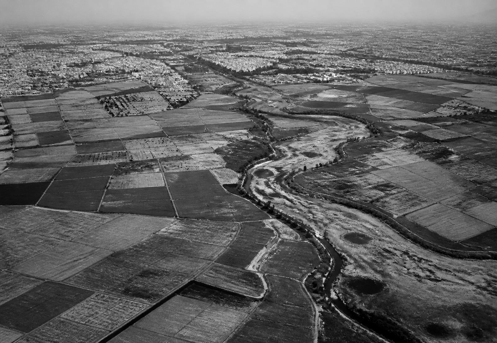
Aerial context photograph of the Atlas New Town study area
Context — study area
Framework area
410 ha
Modelled units
≈ 11 000
Employment land
56 ha
Horizon
25 years

The study

From context to implementation.

Context

Agricultural land at the edge of a growing metropolitan region faces conversion pressure. Ad hoc approval of individual developments would consume the land without infrastructure, employment or public space.

Opportunity

Planning the full 410 hectares as a single structure allows infrastructure to be sized once, employment land to be reserved before it is priced out, and a permanent growth boundary to be established.

Vision

A settlement with a fixed edge: dense, walkable, water-secure, with employment land reserved at the transport interface and agriculture retained beyond the boundary.

Masterplan

A central linear spine carries public transport, civic uses and the highest densities. Employment land occupies the regional road interface. Residential quarters of roughly 40 hectares each are structured around a school, a square and a water attenuation park.

Urban systems

A continuous public transport spine with 500 metre stop spacing; a fine-grained street grid at 80 by 110 metres; a cycling network on the attenuation corridors.

Housing strategy

Approximately 11 000 units modelled across five income bands, with a minimum of 30 per cent of units in each quarter allocated to the two lowest bands.

Infrastructure

Water security is the structuring constraint: local aquifer recharge, full greywater reticulation and attenuation-first stormwater. Energy is planned for distributed generation with a grid interface.

Landscape

Attenuation corridors form the primary green system, doubling as cycling routes and sports space. The agricultural edge is retained as a productive buffer.

Economic impact

56 hectares of employment land are reserved at the regional interface, with a phasing rule preventing residential release beyond a threshold until employment land is activated.

Environmental impact

Fixed growth boundary, retained agricultural buffer, aquifer recharge, and no development within the wetland system.

Drawings

Interactive technical set.

Regional analysis

Water, agriculture, movement and growth pressure.

Structure plan

Spine, quarters, employment land and fixed boundary.

Spine section

Transport, civic frontage and density transition.

Phasing thresholds

Residential release tied to employment activation.

Delivery

Implementation timeline.

  1. FrameworkYear 0–2

    Structure plan approval, environmental authorisation, land assembly.

  2. Quarter OneYear 2–6

    Spine infrastructure, first quarter, first employment parcels.

  3. Quarters Two–ThreeYear 6–14

    Residential expansion tied to employment activation thresholds.

  4. CompletionYear 14–25

    Final quarters, civic core, boundary consolidation.

Estimated budget

  • Bulk infrastructure and spineIndicative — capacity study pending
  • Public realm and attenuation systemIndicative
  • Housing deliveryModelled per band and phase

Budget figures are indicative and modelled for planning purposes only. They are not tendered costs and do not constitute a commitment or an offer.

Contact

Discuss this project.

Framework documentation is available to municipalities, landowners and investment partners on request.